Mars Terrain
← previous: Terrain Navigation · next: Mars on GPU Physics →
The plain words boxes like this one carry the whole story; the technical detail around them is there if you want it.
The one line version: we built a Martian landscape first, with no robot in it at all, and only then put a walker on it. The walker does avoid obstacles — but it turns out it is feeling them, not seeing them, because a robot given no information at all avoids them just as well.
Abstract
Part 1 — the ground. This half builds a Martian surface and then tries to catch it lying. There is no robot in it — no policy, no reward, no success rate. That is deliberate: the previous lab published a result that turned out to be wrong, and the faults were in its world, its renderer and its measurement rather than in anything the robot learned. So terrain gets its own lab, built first and measured on its own terms. What follows is a generator at two scales, six animations, seven properties that can fail, and three bugs found by checking rather than looking.
Part 2 — the robot. Trains a PPO navigator on that surface, and it works: about one episode in seven reaches the goal on the full 10.4° terrain. Getting there took two corrections. The torso pitch and roll that labs 1–4 lock had to be freed, because a body that cannot tilt cannot stand on ground that is uneven everywhere. And then six training configurations in a row scored exactly 0%, which we spent hours attributing to the terrain before measuring the thing that actually mattered: the robot walks about 6 m of sloped ground per episode, and the task was asking for 24. The terrain was never the obstacle; the route length was.
Part 4 — forcing the decision. Rebuilds the task so every map makes the robot choose: a 34 m arena, twice the blocker density, and a detour on 13 of 13 maps. Nothing solves it — all six runs score zero. The lab now holds a correctly specified hard problem with a measured baseline, which is a better place to be than a mis-specified easy one.
Part 3 — the decision. Asks the question the lab was built around and had never tested: does the robot actually tell a climbable dune from a cliff-edged scarp? It does — it crosses climbable landforms about three times as often. But a policy fed six constant zeros discriminates just as well, so the behaviour is emergent from embodiment, not perception: you learn a scarp is impassable by walking into one.
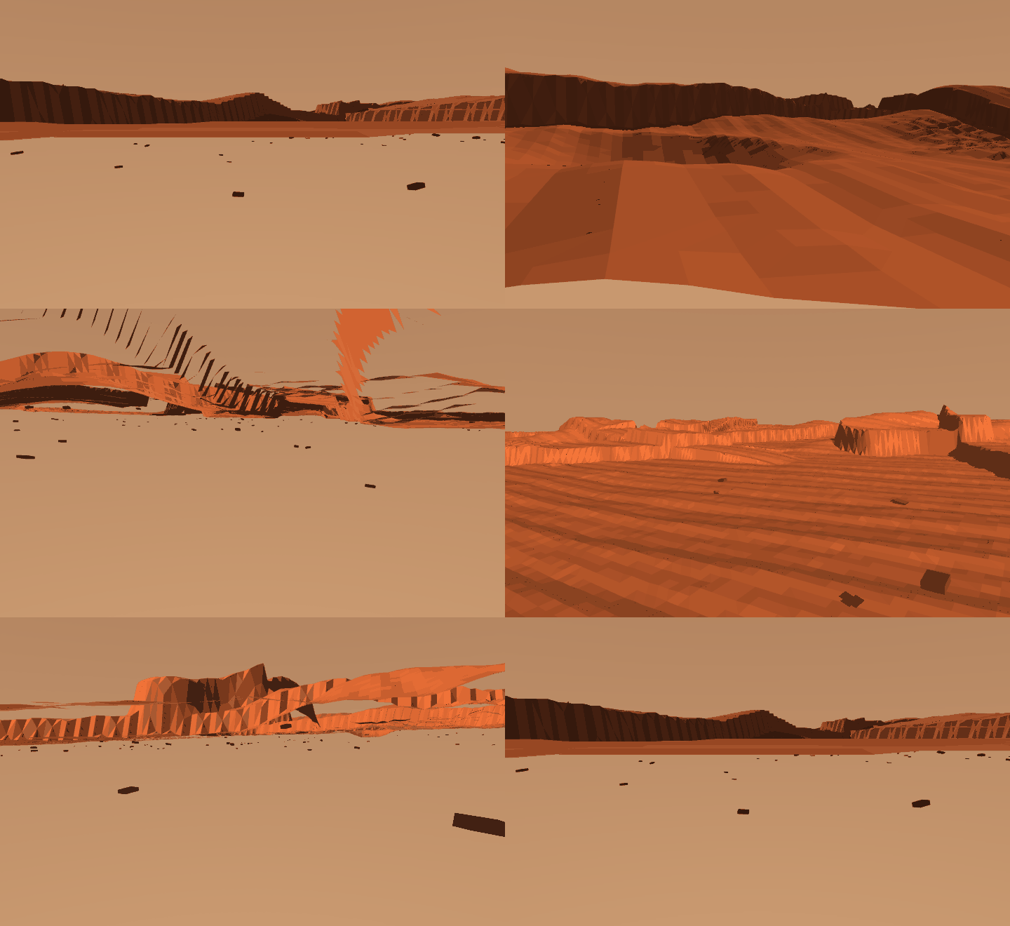
How this lab works
A generated planet, built in two separate parts on purpose: a world first, with no robot in it at all, and only then a policy to walk on it.
The split exists because lab 4 published a result that was wrong, and the faults were in its world, its renderer and its metric rather than in anything a policy had learned. Terrain and policy are different problems; mixing them leaves you unable to say which one broke.
The finding: the robot avoids obstacles by contact, not by seeing them. A policy given constant zeros discriminates just as well — you learn a scarp is impassable by walking into one. Arrival rate alone could never have told these apart.
Problem Statement
Build a stretch of Mars, then teach a robot to walk across it. The landscape is built and checked completely separately from the robot, so that if something goes wrong we know which half broke.
Procedural noise will give you something that looks like a planet in about twenty lines. The hard question is different:
What has to be true of a generated world before you are entitled to believe anything you measure on it?
Terrain is unusually good at hiding mistakes, because the only check most people run is whether it looks right — and a height field almost always looks right. One of the bugs below produced a surface with 46 m of relief inside a 60 m box, a near-vertical cliff-world, and it still rendered as perfectly reasonable ground.
Two scales, because the famous landforms do not fit
Olympus Mons is roughly 600 km across and 22 km tall. Valles Marineris runs about 4,000 km. A robot arena is tens of metres across. Neither fits, and a two-metre bump labelled "Olympus Mons" would be a lie told with geometry.
| preset | extent | purpose |
|---|---|---|
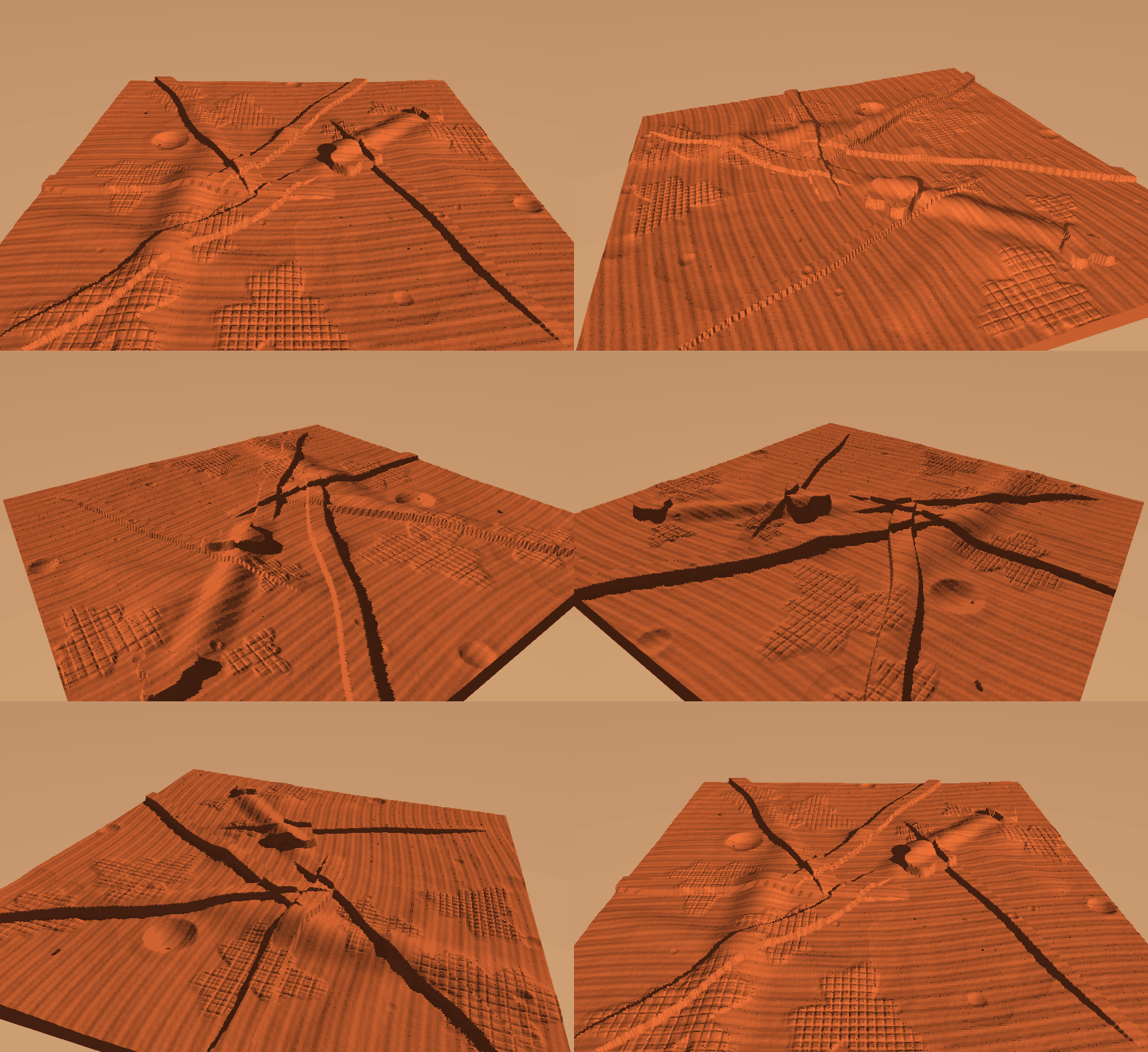
regional | 20 km | shield volcano, rift canyon, graben swarms, cratered highlands, the crustal dichotomy. For looking at. |
rover | 60 m | dune ridges, scarps, boulder fields, small craters, fractured bedrock. Part 2 walks here. |
The rover map is a local sample of a Martian-looking surface, not a scale model of Mars. Saying so is cheaper than pretending otherwise and being caught by anyone who knows the numbers.
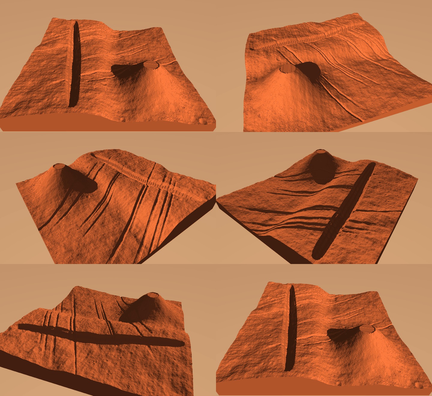
Solution
What is modelled
Each of these changes the shape of the ground, which is the test for whether it belongs in a height field at all:
- the crustal dichotomy — smooth low northern plains against high, rough, ancient southern highlands. Regional only: a 60 m patch does not straddle a hemispheric boundary, and applying it there produced a "dichotomy" of 0.7 m, which is not a dichotomy, it is a slope.
- impact craters with raised rims, bowls and ejecta, drawn from a power-law size distribution and each carrying an age — sharp young bowls superimposed on soft, half-filled old ones. A plain where every crater is fresh looks like a golf ball.
- a shield volcano, far flatter than anyone draws it, with a summit caldera rather than a cone
- a rift canyon with terraced walls, plus swarms of parallel graben. Fossae come in sets sharing one orientation, because they are extensional fractures from a common stress field — the parallelism is the part that reads as real.
- dendritic dry channels that run downhill and join
- aeolian ripples, transverse to one prevailing wind
- surface rock as angular platy slabs, not spheres
- patches of exposed, fractured bedrock pavement
What is not
Polar ice caps — a square tile has no pole in it, and a white blob in the corner would be decoration. Atmospheric scattering. Real MOLA elevation data. Regolith mechanics: the ground here is rigid, and sinkage and slip are a much harder lab.
The two affordance classes
A surface without a decision in it is scenery. Mars supplies both shapes needed to make it a task:
The mesa is the interesting obstacle. Its top is as traversable as the open plain — only the shoulder stops you — so height alone does not tell a robot whether it can be there. It has to read the edge. The 0.12 m threshold is inherited from lab 2, which measured a two-legged robot climbing 0.04–0.10 m treads reliably and failing above that.
Experiments and Results
Twenty seeds at both scales, via uv run mars.py --check 20:
| rover (60 m) | regional (20 km) | |
|---|---|---|
| relief | 2.7–4.0 m | ~4.2 km |
| slope, mean | 6–10° | 22° |
| walkable (rise ≤ 0.12 m) | 96% | — |
| crater exponent b | ~1.9 | 2.02 |
| edge blocked, climbable class | 4–6% | — |
| edge blocked, cliff class | 17–24% | — |
The classes separate by about 3× at the edge. That separation is the property this lab exists to produce, and it is measured rather than asserted — the constants that generate it could be right by accident, and twice they were not.
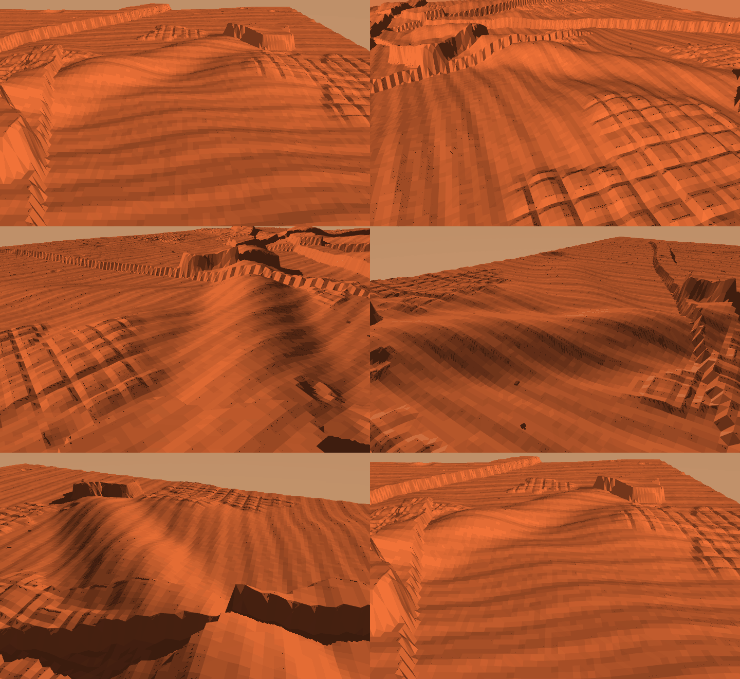
Craters are drawn from and the fitted exponent comes back at 2.02, against the ~2 seen in real crater counts. That fit is a test, not a decoration: a uniform sample fits , and the suite asserts that such a sample is rejected. A check you have not watched fail is not a check.
What does not work yet
Refusing to climb saves a median of +1.24 m, and only 5 of 10 seeds save more than a metre. Lab 4's arena — a quarter of the area — reached +3.40 m.
With 96% of cells walkable, a route can usually avoid every obstacle for free. The fix is probably not more obstacles but goal placement: lab 4 found that where you put A and B decides whether the terrain's decision actually binds. That is a Part 2 question and it is listed here rather than discovered there.
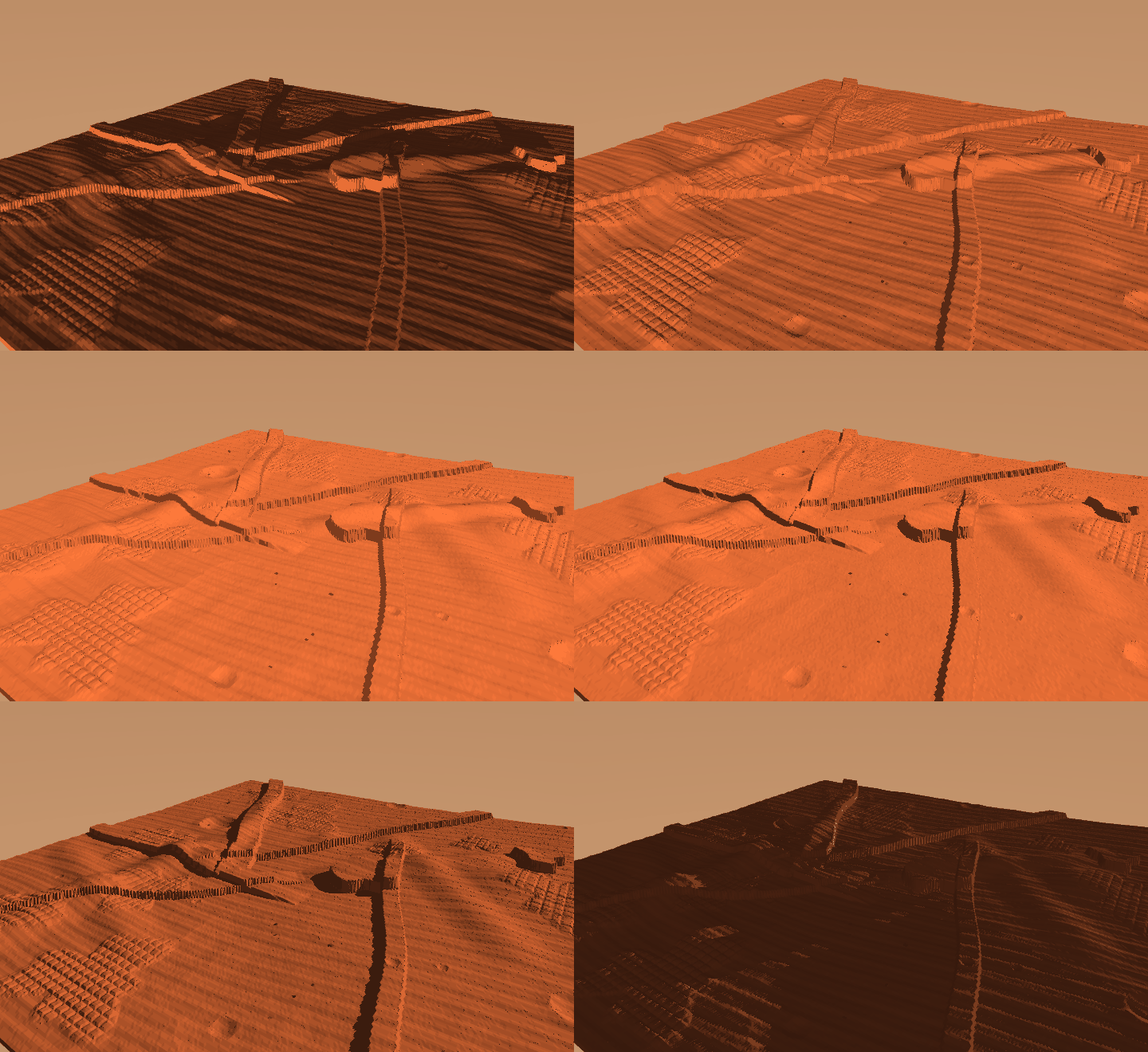
Relief is invisible at noon and obvious at low sun. That is not only atmosphere: shadow length is how a human reads terrain, and it is what a vision-based policy would key on too.
What Went Wrong, and What It Taught Us
Three failures while building this. None of them crashed, and each produced output that looked entirely reasonable.
A carve that accumulated. The channel walker subtracted its depth at each of 150 overlapping steps, so a channel asked for 0.15 m was cut tens of metres deep. The result was 46 m of relief inside a 60 m box — and it still looked like terrain. Fixed by accumulating the deepest cut per cell and applying it once; relief is now asserted against the preset, because eyeballing does not distinguish 3 m from 46 m.
A measurement that answered the wrong question. Traversability was averaged over each landform's bounding box, which reported mesas as 86% walkable. True, and useless: the box is mostly the flat top and the surrounding plain. The obstacle is the shoulder, so the measurement now samples a ring at the landform's own radius.
climbing_pays blocked every cell above the median elevation — 38% of
the arena — which walled the map off completely. Every route in the
counterfactual came back infinite, every sample was dropped, the list
ended up empty, and the function returned 0.0.
Eight seeds in a row read +0.00 m. That looks exactly like this
terrain contains no decision in it, and it actually meant nothing
was measured at all. The number was plausible, in range, and pointed
at entirely the wrong culprit — so the natural next move would have
been to redesign terrain that was fine.
It now returns NaN and reports how many samples it actually got.
Zero and no-data are different facts and must not share a
representation.
Part 2 — Putting a robot on it
Part 1 built ground and measured it. Part 2 trains a PPO policy to cross it, the same experiment as lab 4: a random start A, a random goal B, and arms that differ only in whether the robot is told what the terrain ahead looks like.
It does not work yet, and the reason is the most interesting thing on this page. What follows is the setup, then the measurements, then the wall we hit.
The task
A pair of points is drawn from a pool of 120 pre-solved maps. Both are standable (defined below), the oracle's route between them is 16–30 m long, and that route is at least 15% longer than the straight line — so the path has to bend around something.
That last filter is not cosmetic. Lab 4 capped goal distance by walking B backwards along the oracle's route; we tried it here and measured the consequence:
| goal placement | median detour |
|---|---|
| truncate the route (lab 4's method) | 1.00–1.07× |
| select naturally-bent pairs | 1.58× |
Truncation lands B on the straight run before the first obstacle. The route is the right length and contains no decision. Selecting on both properties is what keeps the task a navigation problem.
What the robot observes
The goal is given as range and the sine and cosine of relative bearing , never as world coordinates — a world-frame goal invites memorising positions in a fixed arena, and a relative one is the same problem wherever you put it.
The privileged channel is six numbers: for each of three directions, the worst rise within 3 m, and a bit for whether the gait can clear it. Rises are measured relative to the ground the robot stands on, because the decision is about the step it must clear, not about altitude.
Three arms, differing only here:
| arm | dims | what it gets |
|---|---|---|
| blind | 25 | proprioception + goal |
| privileged | 31 | + the six terrain features |
| padded | 31 | + six constant zeros |
The padded arm is the control lab 4 needed and lacked: blind vs privileged changes information and dimensionality together, so without it you cannot attribute a difference to either.
The reward
Three of those four terms exist because of a specific failure:
- Progress, not forward velocity. Running north at full speed when the goal is east is worth nothing. Paying for velocity produces a robot that sprints in a straight line and ignores B.
- Alive at 1.5, not 0.5. Too small and the policy learns to fall over immediately, because falling ends the episode and ends the accumulating control cost.
- The arrival bonus is paid once, and arriving does NOT end the episode. Terminating on success made success the worst outcome: standing still for 2000 steps earned 3000, while arriving at step ~700 earned 1170. The policy correctly learned not to arrive.
The robot has two more joints than lab 4's
Labs 1–4 locked torso pitch and roll deliberately — freeing them gives you the bipedal-balance problem on top of whatever the lab is about, and with two legs it cost return and bought no climbing. That reasoning depended on their ground being flat with obstacles standing on it, and Mars is not like that.
Measurement 1: the locked torso has a slope ceiling
The lab-4 robot, walking with a trained gait, on the same route, with only the terrain relief scaled:
| mean ground slope | distance walked |
|---|---|
| 0.0° | 9.8 m |
| 0.7° | 11.6 m |
| 1.3° | 5.3 m |
| 2.6° | 0.64 m |
| 4.3° | 0.43 m |
| 10.4° (Mars as generated) | 0.31 m |
It stops dead somewhere between 1.3° and 2.6°, long before anything Mars would call a hill. Removing all 140 boulders changes nothing (0.36 m either way); flattening the height field restores it completely (8.89 m). The obstacle is not the obstacles — it is the continuous unevenness between them.
So the two joints come back. Part 2 is balance and navigation by necessity, not by ambition.
Measurement 2: freed, it walks — on flat
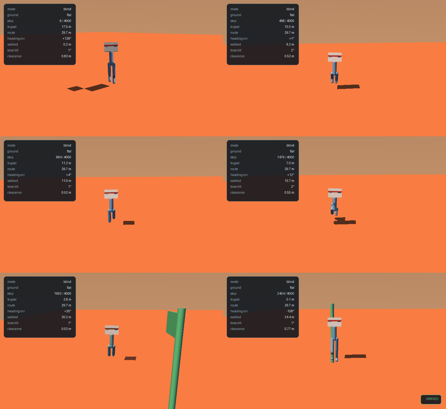
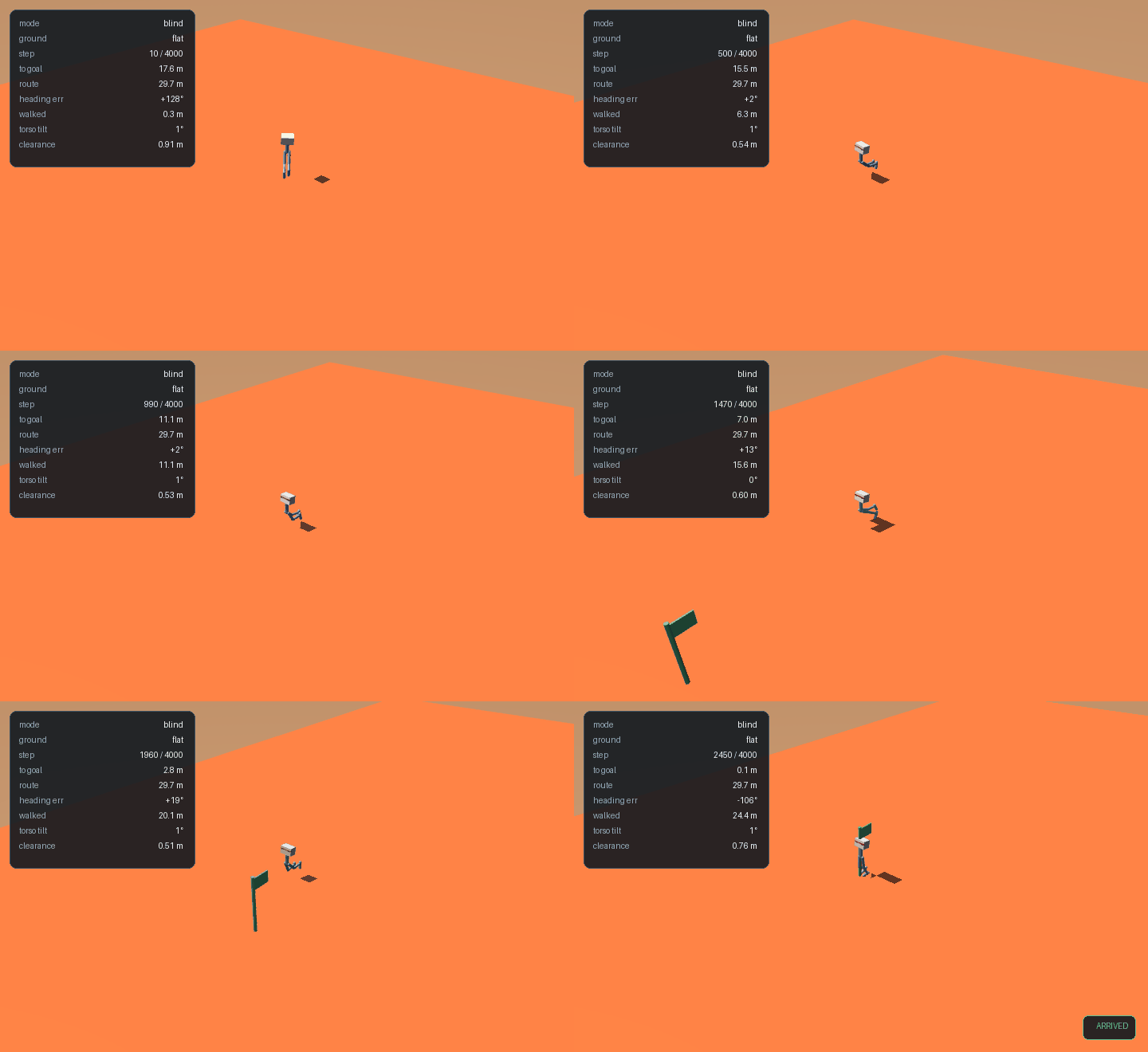
With pitch and roll free, trained on flat ground: 100% arrival, mean distance remaining 0.1 m.
Measurement 3: the first attempt failed, and the terrain was not why
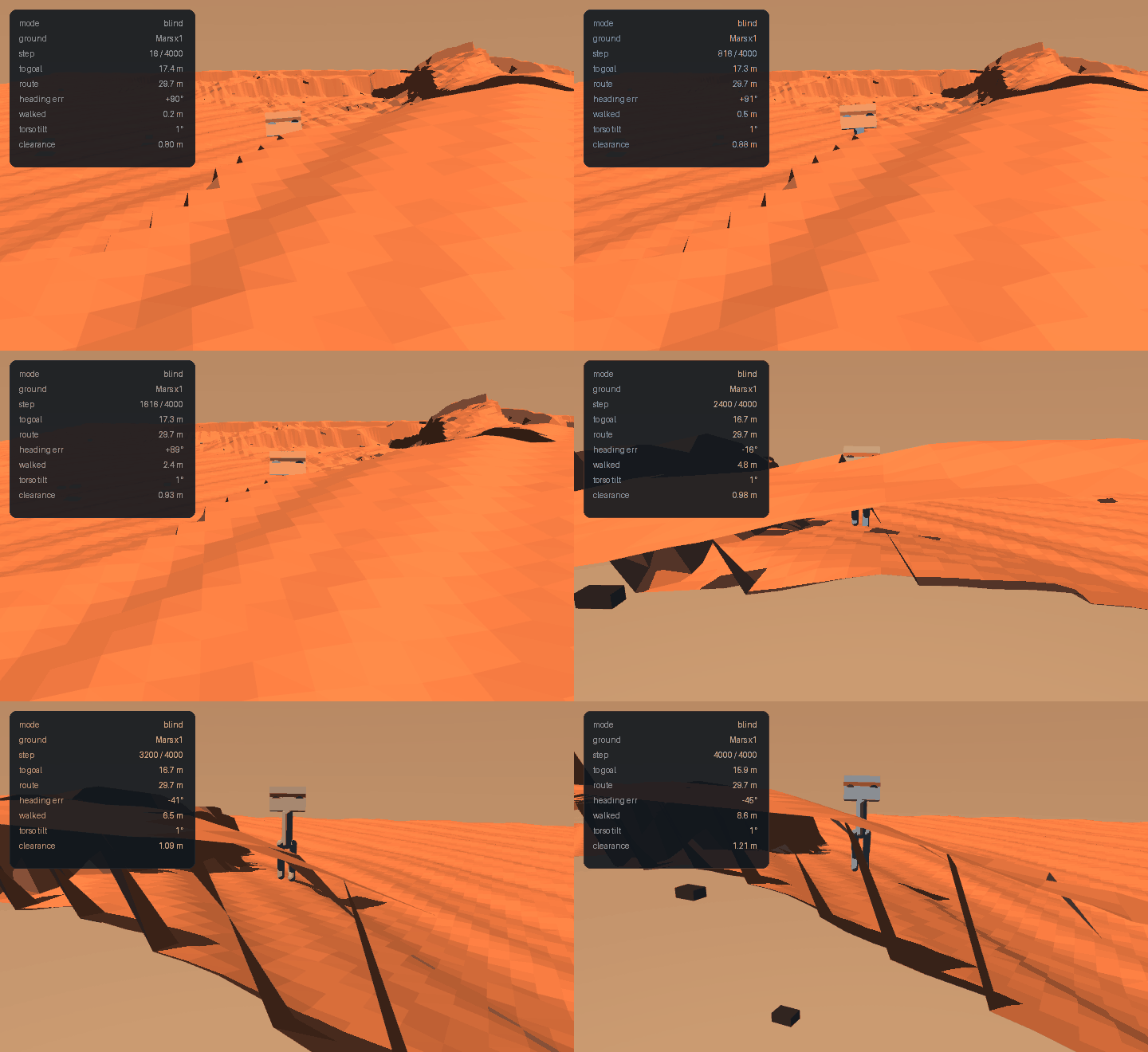
The flat-trained policy, dropped on Mars, walked 8.6 m of a 29.7 m route and timed out. Every training strategy we tried on that task stalled at exactly 0%:
Lab 8 found that fallen() was not a fall
detector. It tested clearance < threshold — torso height above the
ground directly beneath it — so on uneven terrain it fires whenever
the ground rises, not when the robot tips. Measured on Mars
relief: 13 of 13 trigger events happened at a torso tilt of
0–1°. Not one was a fall.
So the 75–83% figures in this table conflate genuine falls with the robot's belly meeting a rise. The arrival rates — all 0% — are unaffected, and the conclusion that the flat-trained policy cannot cross Mars stands. The fall numbers should be read as an upper bound on falling, not a measurement of it.
The detector now tests the robot rather than the world (tilt > 60°
or torso-above-its-own-feet collapsed), and lab 8 re-measures this
biped at 16.7% [8, 32] over 36 episodes.
| strategy | steps | arrival | note |
|---|---|---|---|
| cold start on Mars | 900k | 0% | fall rate rose 75% → 83% |
| warm start, flat → Mars | 246k | 0% | 83% falling |
| graded ladder, 1.9° → 10.4° | 450k × 5 | 0% | every rung |
| + posture reward | 900k | 0% | |
| + 147k-parameter policy | 900k | 0% | |
| + finer ladder from 0.6° | 400k × 3 | 0% |
Six configurations, one number. That is the tell, and we read it too slowly: when posture, network size, curriculum and step budget all produce an identical result, none of them is the variable that matters.
Measurement 4: it was the route length
The locked-torso ceiling measured earlier is a gradual decline, not a cliff — and the freed-torso robot behaves the same way:
| mean slope | 0.0° | 0.7° | 1.3° | 1.9° | 3.7° |
|---|---|---|---|---|---|
| distance walked | 10.4 m | 11.6 m | 8.2 m | 5.9 m | 1.2 m |
The robot manages roughly 6 m of sloped ground per episode. The task was asking for 24.
That is a task-specification error, not a terrain property. Lab 4 — an easier problem, flat ground with discrete obstacles — used routes of about 7 m in a 20 m arena. This lab asked for three times the distance on continuously uneven ground and then blamed the ground.
Shortening the route band to 6–11 m, with nothing else changed, a policy that had never trained on Mars at all immediately arrived:
| slope | zero-shot arrivals |
|---|---|
| 1.9° | 3/12 |
| 6.3° | 1/12 |
| 10.4° (full Mars) | 1/12 |
The result
Six runs, three arms, two seeds each, trained on the full 10.4° surface and scored on 120 episodes per checkpoint:
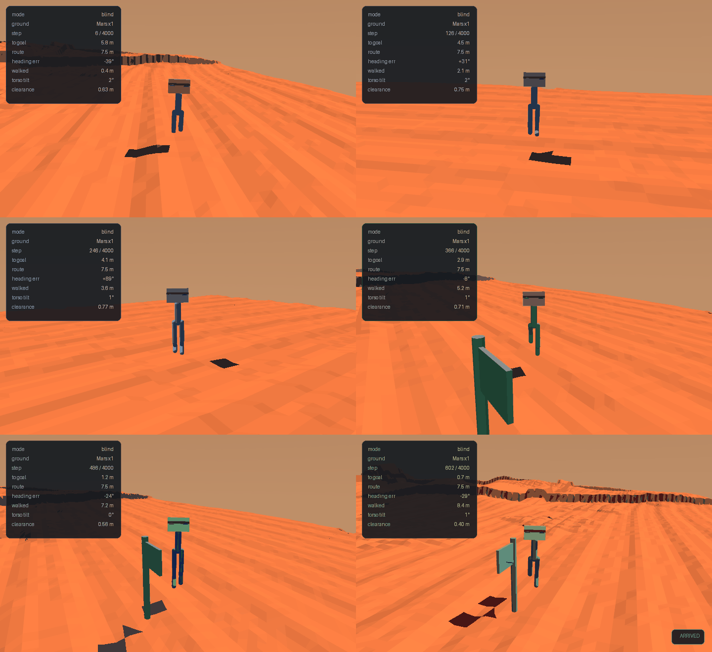
| arm | seed 0 | seed 1 | pooled | Wilson 95% | path efficiency |
|---|---|---|---|---|---|
| blind | 17.5% | 11.7% | 14.6% | 10.7–19.6% | 66%, 63% |
| privileged | 8.3% | 16.7% | 12.5% | 8.9–17.3% | 81%, 81% |
| padded | 4.2% | 11.7% | ~8% | — | 46%, 55% |
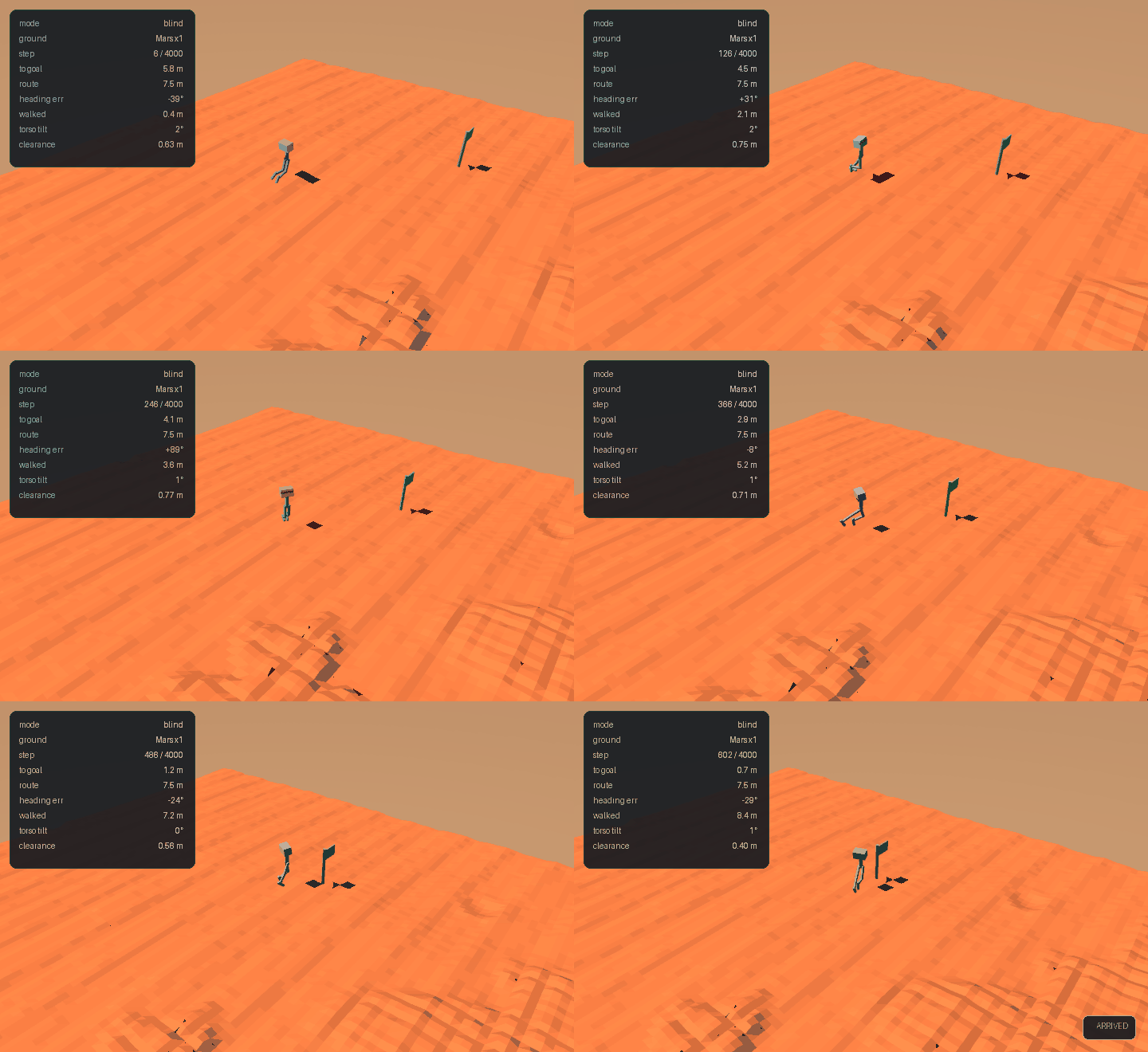
The robot crosses Mars. Not often — about one episode in seven — but on the full generated surface, with its craters, scarps, dunes and 140 colliding boulders.
Blind is nominally ahead of privileged and that means nothing: the Wilson intervals overlap across almost their whole range. No blind-versus-privileged claim is made here, and the arm ordering in that table should be read as noise.
The one pattern worth noting is path efficiency: both privileged seeds hit 81%, above every blind and padded run. Two seeds is still two seeds, so it is logged as worth testing, not as a result.
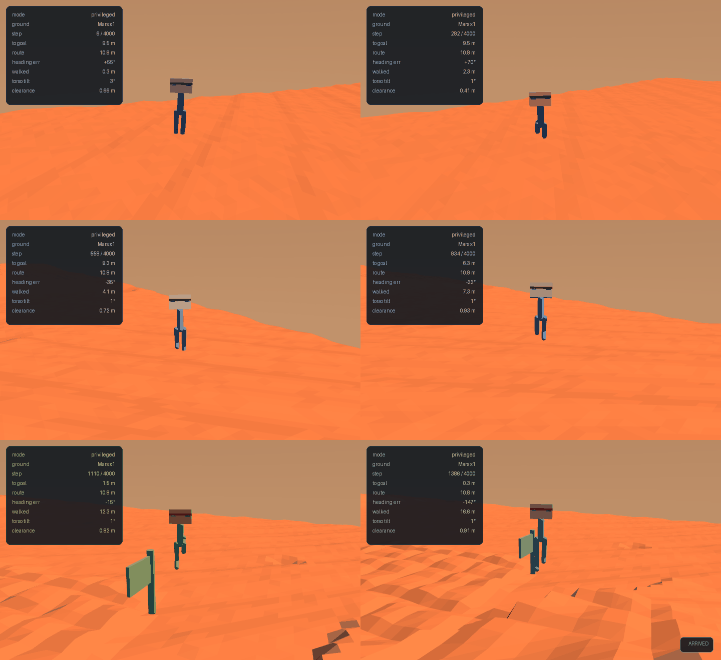
During training the same six runs read 25–42% arrival. At 120
episodes they read 12–18%. Twelve episodes quantise to 8.3% a step,
and this lab's predecessor has a documented history of 12-episode
figures being published as findings. Everything in the table above
comes from evaluate.py.
What this cost, and what it bought
The honest accounting: roughly six hours of compute went into proving that a robot could not cross Mars, and the obstacle was a number in the task generator. The experiments that chased the wrong cause were not wasted — the ladder and the ablation are what rule out terrain roughness, posture, policy size and curriculum as explanations — but the ordering was wrong. The distance the robot could walk was measurable in ten minutes and we measured it last.
One leftover worth stating: a privileged episode scored 223% path efficiency, walking 3.4 m against a 7.6 m "optimal" route. That is the conservative-oracle effect from Part 1 at its extreme — the planner routes around terrain the robot simply walks over. The efficiency figures above are therefore a lower bound on how direct these paths are.
Part 3 — Does it actually tell the two classes apart?
Part 1 built two landform classes and measured that they afford different things. Part 2 trained a policy that reaches the goal about one episode in seven. Neither checked the thing in between.
A robot can score 15% while treating every obstacle identically — going around all of them, or blundering over all of them and surviving the ones that happen to be climbable. Arrival rate cannot distinguish those, and arrival rate is all we had measured. Three separate experiments, and the lab's central claim was still untested.
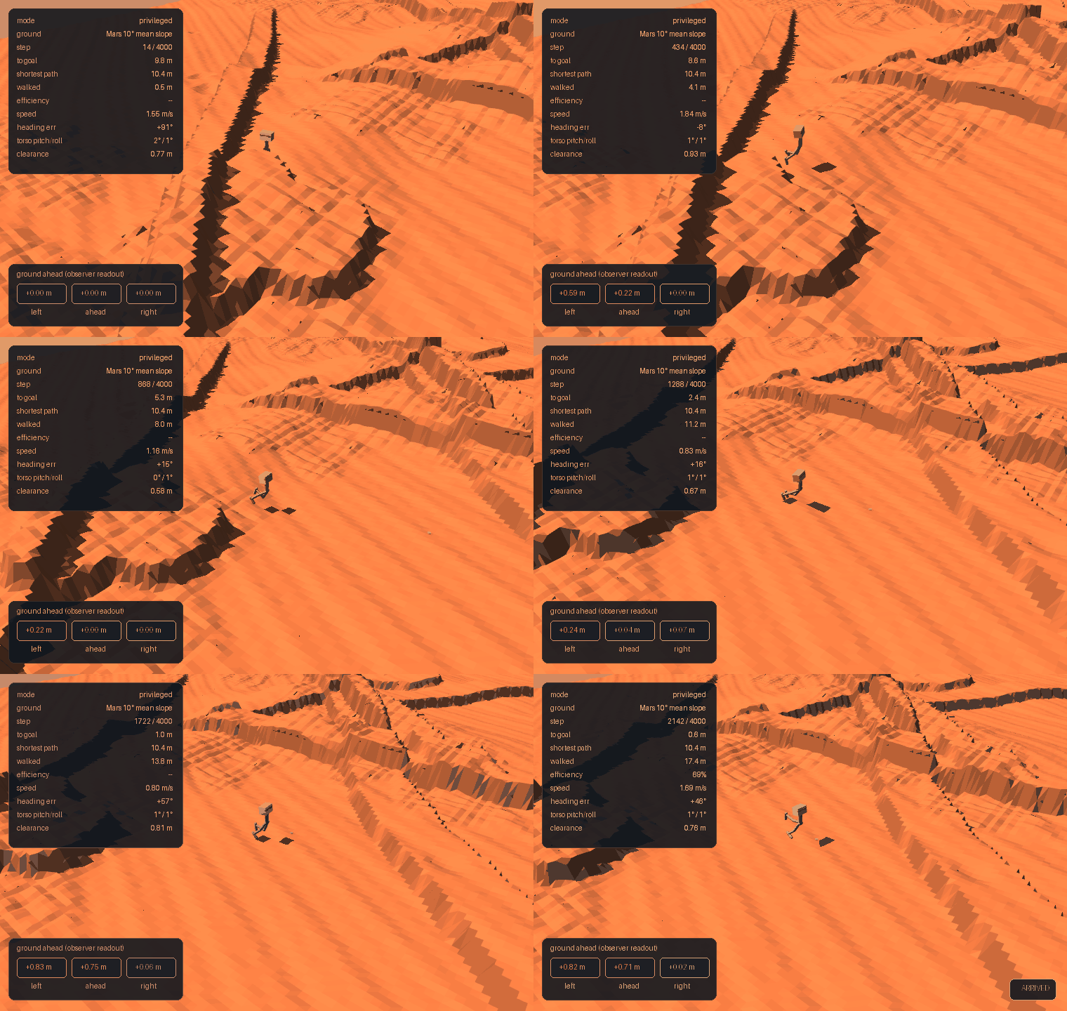
Measuring behaviour instead of outcome
analyze_decisions.py replays existing checkpoints and watches what
the robot does. For every landform its path comes near, it records
whether the robot went over it or around it:
Near zero means the policy treats them the same whatever it scores. Two choices in that measurement matter:
- Landforms the robot never approached are excluded, not counted as successful avoidance. Scoring distant obstacles as "correctly avoided" manufactures a competence that was never exercised — the same error as Part 1's bounding-box measurement.
- A non-zero cross rate on "blocked" is not automatically a
mistake.
traversable()is conservative: one episode walked 3.4 m where the planner routed 7.6 m around terrain the robot simply climbed.
The result, 180 episodes per policy
| policy | crosses climbable | crosses blocked | difference |
|---|---|---|---|
| blind | 56% [42–69] | 18% [6–41] | +39% |
| privileged | 63% [49–75] | 24% [10–47] | +40% |
| padded (six constant zeros) | 57% [43–69] | 25% [11–47] | +32% |
The robot does tell them apart. It crosses climbable landforms about three times as often as blocked ones, and within each policy the two intervals barely touch.
The padded arm receives six constant zeros — no terrain information whatsoever — and discriminates just as well as the privileged arm that is handed the ground profile.
So the behaviour is real but it is not perception. It is emergent from having a body: you walk into a scarp and physics stops you; you walk onto a dune and it works. The policy does not need to be told which is which, because the world tells it on contact.
This also explains Part 2's null. Privileged never beat blind on arrival because the terrain channel was supplying information the robot was already getting for free.
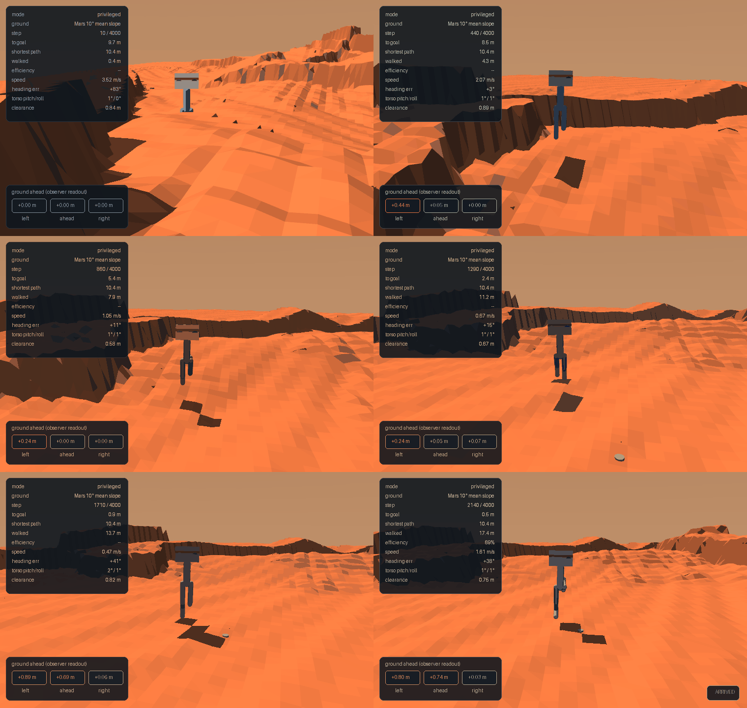
What this does not settle
Contact-based discrimination is not free — it is just cheap here. Learning a scarp is impassable by walking into it costs the walk. That cost is small when the detour is small, and these routes barely bend: the shipped task pool has a median detour of 1.10×, and only 31 of 100 maps exceed 1.15×.
That is the condition under which advance knowledge should finally matter, and this lab has not created it yet. A robot that must commit to going left or right before reaching a 20 m scarp cannot afford to find out by collision.
The statistics in this section are unfiltered — 180 consecutive episodes per policy. The animation is not: an episode that arrives and crosses a climbable landform and meets a blocked one occurred once in 140 seeds.
That rarity is not an aside, it is the finding restated. At a 1.10× detour, most episodes never present the decision at all.
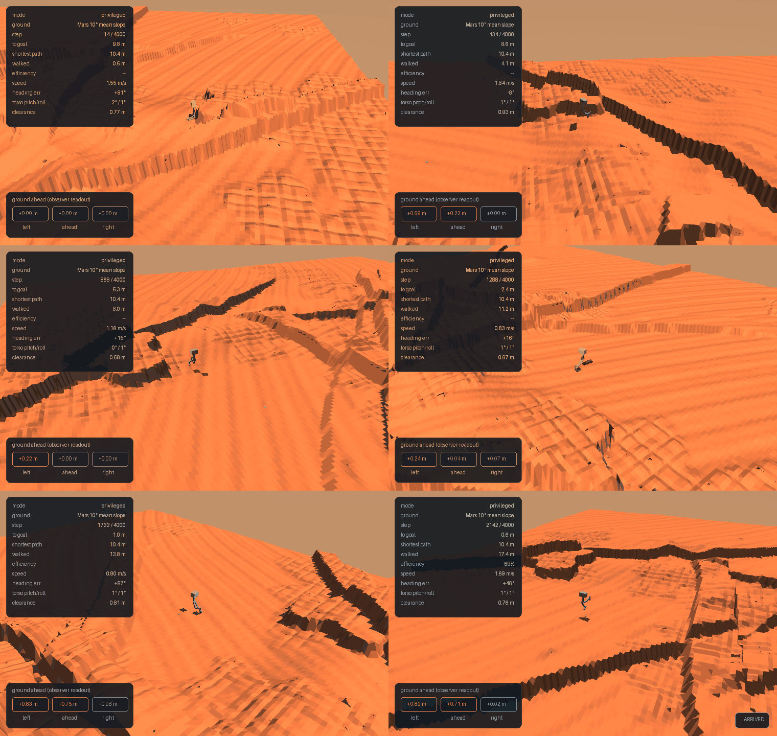
Next
Place A and B deliberately on opposite sides of a blocker, so a short route is forced to bend. Same terrain, same robot, same budget — the only change is that the decision becomes unavoidable. If the privileged arm is ever going to beat blind, that is where it happens.
Part 4 — Forcing the decision, and failing to solve it
Part 3 ended with a complaint about its own task: the robot discriminates obstacles by contact, and contact is cheap only because the routes barely bend. Median detour 1.10×. Most episodes never present the choice at all.
Part 4 builds the task that does, and then fails to solve it. Both halves are the result.
Why the obstacles were in the wrong place
Placing A and B across a blocker — stepping perpendicular off a scarp in both directions, so the straight line passes through it — raises the detour to 1.44×. But it also lengthens the route to 12.3 m, and the robot manages about 6 m on sloped ground. Constrain the route back to 8 m and the detour collapses to 1.09×, because the only blockers short enough to fit are small enough to skirt.
The resolution is a ratio, not a length:
| route | arena | route / arena | detour | |
|---|---|---|---|---|
| lab 4 (works) | 7 m | 20 m | 35% | 1.36× |
| lab 5 Part 2 | 8 m | 60 m | 13% | 1.10× |
| Part 4 course | 8.8 m | 34 m | 26% | 1.39× |
At 60 m the robot's route crosses an eighth of the arena, so blockers sit beside the path. Shrink the box, hold the route, and the same generator produces a forced detour on 13 of 13 maps. This is lab 4's geometry lesson arrived at from the opposite direction: what creates the decision is the ratio of route to arena, not the absolute size of either.
The course
Denser than the 60 m arena in both senses — more landforms per square metre, and more of them across any given route:
| 60 m arena | course (34 m) | |
|---|---|---|
| mean slope | 9.9° | 10.7° |
| landform density | 4.2 / 1000 m² | 8.7 / 1000 m² |
| detour | 1.10× | 1.39× |
| maps forcing a detour | 31% | 13 / 13 |
The result: zero
Three arms, two seeds, 1.2M steps each, warm-started from flat policies that reach 67–92% arrival. Scored on 120 episodes:
| arm | seed 0 | seed 1 |
|---|---|---|
| blind | 0.0% | 0.8% |
| privileged | 0.0% | 0.0% |
| padded | 0.8% | 0.0% |
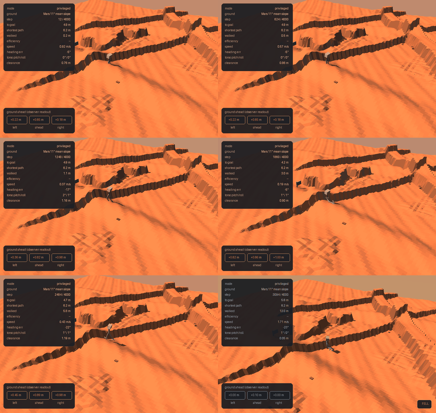
Nothing solves it. The robot walks 8.8 m on rough Mars and discriminates obstacles by contact, but it cannot route around a blocker and arrive.
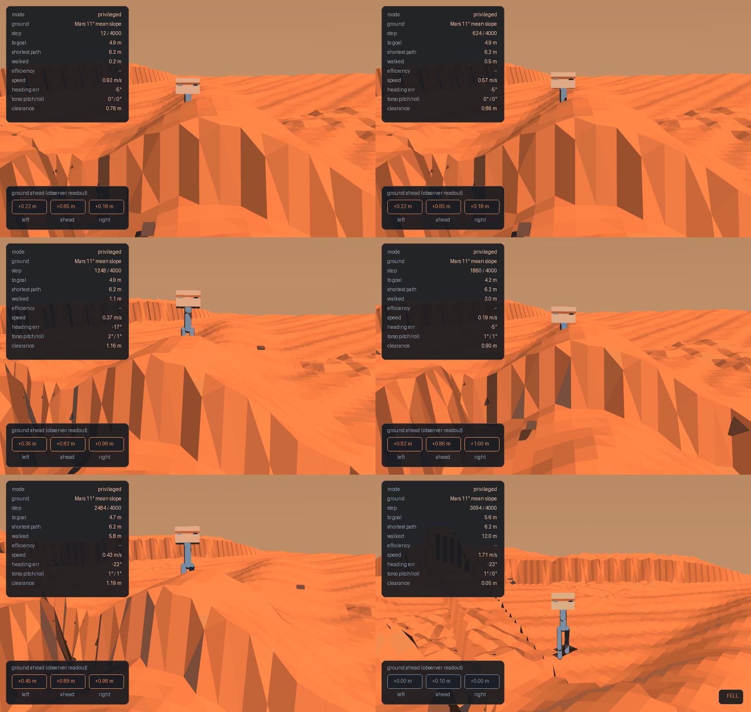
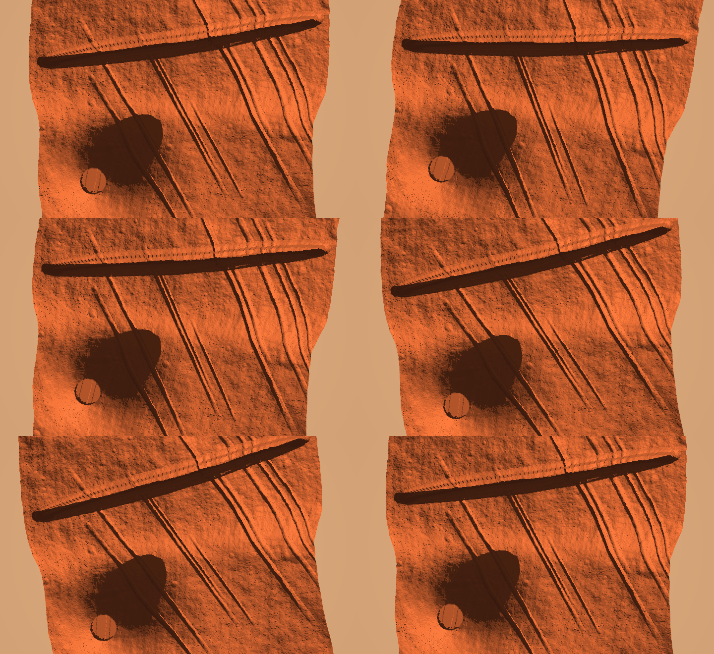
The frame above is the whole thing: pressed against a scarp, all three ground-ahead readings red — every direction over the 0.12 m step limit — 4.7 m from a goal it cannot reach. In that episode it walked 12.0 m against a 6.2 m route and fell. It is not failing to walk. It is failing to give up on a heading.
A correctly specified hard task with a measured zero baseline, which is a better position than the one it was in two parts ago: a mis-specified easy task scoring 15% on a decision it never had to make.
The honest summary across the whole lab: we can build Martian ground and measure it, a robot can cross it when the way is roughly clear, it tells climbable from impassable by bumping into things, and it cannot yet plan around an obstacle. The last of those is where the interesting work starts.
What would plausibly crack it
Stated with their real costs, because none of them is free:
- More training. 1.2M steps is small. Lab 4 used 1.5M for a task with no balance component and no forced detour; this adds both. 5–10M is the realistic ask — a day or more per arm on CPU.
- Fix locomotion first. The ~6 m range on sloped ground is the constraint behind every result on this page. A dedicated locomotion curriculum, with navigation added only afterwards.
- MJX on GPU. Not for the policy — a 12k-parameter network is 4.6× slower on a GPU at our batch size, measured. For the physics: thousands of parallel environments, which is what makes (1) affordable at all.
Before accepting the null we probed whether a shorter route band would help, by running a flat-trained policy zero-shot on forced courses. It scored 0/14 at every band, which looks like evidence and is not: a policy trained on open ground walks straight at the goal bearing, and on these maps that bearing points directly into a scarp. The probe could not distinguish "too hard to learn" from "this particular policy has no detour behaviour to transfer". The trained runs are the evidence; the probe is recorded here because it took a second look to notice it proved nothing.
What This Lab Does Not Claim
- This is not Mars. It is procedural terrain matched to published descriptions and surface imagery. MOLA data exists; this is not it.
- No robot has walked here. Traversability is computed from a gait rule, not demonstrated. Part 2 is where that claim gets earned.
- The routing decision is weak — +1.24 m median, 5 of 10 seeds.
- The palette is a presentation choice, not a result. Nothing here simulates scattering. The sky is butterscotch because fine suspended dust reddens transmitted light and surface imagery shows it that way; rendering a blue sky over red ground is the single most common way a "Mars" picture announces that nobody checked.
- Part 4's course is unsolved. Three arms, two seeds, 1.2M steps each, all at or below 0.8% arrival. The baseline to beat is zero.
- No blind-vs-privileged conclusion anywhere on this page. Part 2's arms were separated by less than their confidence intervals, Part 3 found the terrain channel adds nothing to obstacle discrimination, and Part 4 scores zero for everyone.
Running It
cd 07_physical_ai/05_mars_terrain
uv sync

uv run mars.py --check 20             # the measurements
uv run mars.py --scale rover --ascii  # one map, in text
uv run render_mars.py --all           # six animations

uv run ../../tests/test_mars_terrain.py   # 17 checks, no GPU
There is no deepspeed call in this lab's launcher and no GPU is
requested for the generator. It trains nothing — no parameters, no
gradients, nothing for ZeRO to shard — so a distributed launcher would
be cargo cult. Only the renderer needs an OpenGL context.
References
- Schulman et al., PPO, 2017 · GAE, 2015
- Lee et al., Learning quadrupedal locomotion over challenging terrain, Science Robotics 2020 — privileged teacher, proprioceptive student
- Rudin et al., Learning to Walk in Minutes Using Massively Parallel Deep RL, CoRL 2021 — thousands of parallel environments on one GPU
- Miki et al., Learning robust perceptive locomotion, Science Robotics 2022 — proprioception and exteroception fused, in the wild
- Perlin, An Image Synthesizer, SIGGRAPH 1985 —
gradient noise, which is what
terrain.pygenerates relief with - Agarwal et al., Deep RL at the Edge of the Statistical Precipice, NeurIPS 2021 — why a handful of seeds and a mean are not enough
- Henderson et al., Deep Reinforcement Learning that Matters, 2018
The terrain generator, the walker and the sim-to-real framing are all standard. What this lab contributes is the split: part 1 builds and validates a world with no robot in it, because lab 4 published a result whose faults were in its terrain, its renderer and its metric rather than in anything a policy learned. And the decision analysis in part 3 — replaying checkpoints to ask whether the robot went OVER or AROUND each landform — which found that an arm fed six constant zeros discriminates about as well as the policy does.